

Filter
This section contains evaluation functions for the object on which the instances are placed. For example, instances can be restricted to growing only within a specific elevation range, or they can be automatically removed from sections of terrain that are too steep.

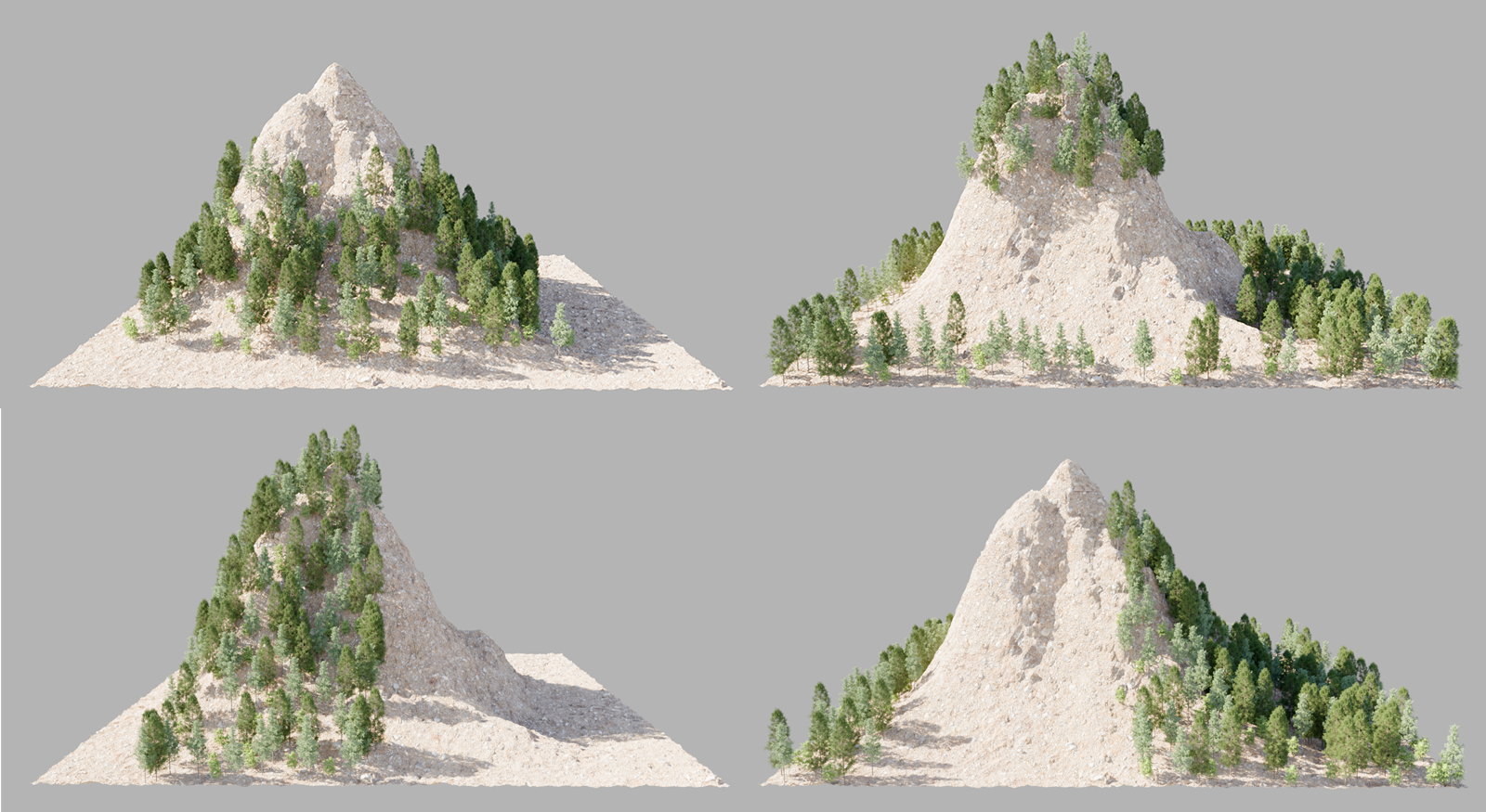
This section contains evaluation functions for the object on which the instances are placed. For example, instances can be restricted to growing only within a specific elevation range, or they can be automatically removed from sections of terrain that are too steep.
Here, you can choose whether the object should react to filter settings at all, and whether these are determined by the Scatter object or by the Scatter tag:
-
Off: Neither the filters configured by the Scatter object nor those configured by the Scatter tag are applied.
-
Inherit: This is the default setting, which causes the tag-carrying object to receive only the filters from the Scatter object.
-
Override: Enable this mode to apply the filter settings set in the tag to the object, thereby overriding the Scatter object's filter settings.
You use these percentages to define a size range within which only instances should remain visible, or to specify the size range from which instances should be removed. These percentages always refer to the size of the bounding box and therefore always indicate the maximum extent of the object over which the instances are distributed. The axis direction of the bounding box to be evaluated is selected via the Axis setting. This means that an instance distribution can also, for example, be restricted along the X-direction and does not necessarily have to correspond to the elevation of a terrain.
As shown in the figure above, the selected area can also be inverted so that only instances outside the specified area remain visible.
This allows you to smoothly transition between the original arrangement of the instances and the placement restricted by the Altitude Min/Altitude Max settings. At 100%, you’ll get exactly the same result as if the Enable option for the Altitude range were disabled.
Here, you specify the axis direction on the bounding box that is to be evaluated for the altitude range. You use the following Object Space option to determine whether the axis directions of the global world axes or the axis directions of the object on which the instances are placed are to be evaluated.
If this option is turned off, the world axes are selected via the Axis menu. Otherwise, the axes of the object on which the instances are distributed are used.
The bounding box dimensions of the object on which the instances will be placed are read based on the selected axis direction and are then used, together with the Altitude settings, to filter out the instances.
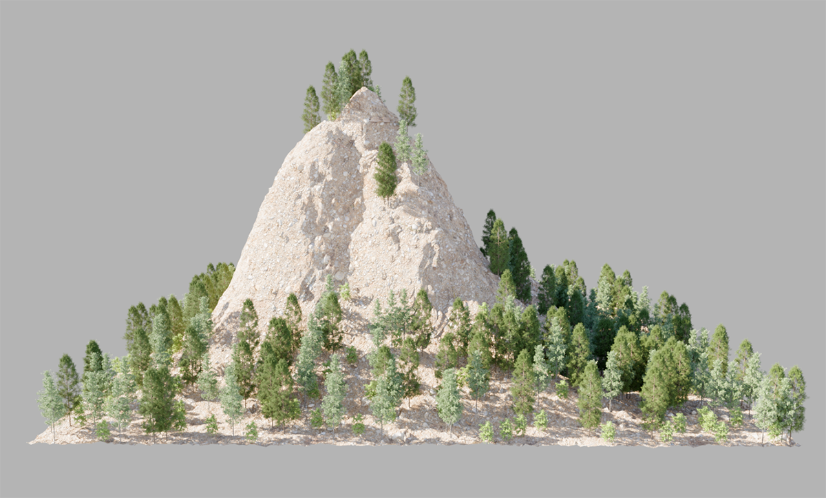
This settings block automatically removes instances that have been placed on surface sections that are too steep. To do this, you can specify angles that are then excluded from, for example, a terrain.
Here, you can choose whether the object should react to filter settings at all, and whether these are determined by the Scatter object or by the Scatter tag:
-
Off: Neither the filters configured by the Scatter object nor those configured by the Scatter tag are applied.
-
Inherit: This is the default setting, which causes the tag-carrying object to receive only the filters from the Scatter object.
-
Override: Enable this mode to apply the filter settings set in the tag to the object, thereby overriding the Scatter object's filter settings.
Here, you specify the minimum and maximum slopes of the terrain that should be kept clear of instances. The surface normal of a landscape is calculated relative to the local axis direction set for the Up-Vector. By default, for a landscape elevating from the XZ plane, a Up-VectorY is already the most appropriate setting. The two angles can then be used to specify the range of slopes that should be excluded from instances. However, by additionally enabling the Invert option, this effect can also be reversed. Only instances within this slope range will then be displayed.
This reverses the filter effect for Slope.
This allows you to smoothly transition between the original arrangement of the instances and the placement restricted by the Angle Min/Angle Max settings. At 100%, you’ll get exactly the same result as if the Enable option for the Slope range were disabled.
The direction selected here is used to calculate the angle of inclination of the surface on which the instances are distributed. In addition to the standard X, Y, and Z directions, an Object can also be assigned. In that case, the line connecting this object to the object used for placing the instances is used as the axis direction.
For regular landscapes that lie in the XZ plane and extend upward along the Y-axis, the default setting of Y is already the correct choice.
Optionally, the Up-Vector calculation can also be based on the position of an object assigned here.
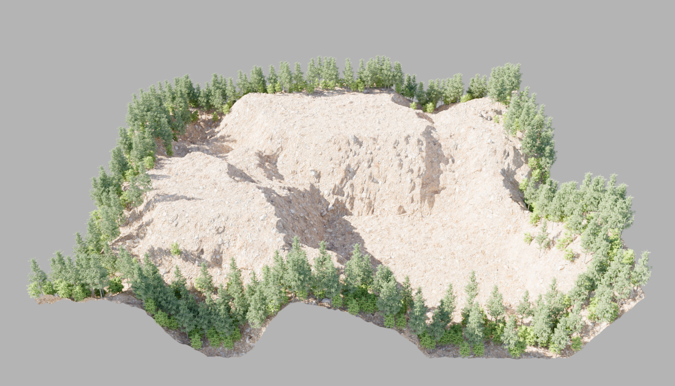
Here, you can choose whether the object should react to filter settings at all, and whether these are determined by the Scatter object or by the Scatter tag:
-
Off: Neither the filters configured by the Scatter object nor those configured by the Scatter tag are applied.
-
Inherit: This is the default setting, which causes the tag-carrying object to receive only the filters from the Scatter object.
-
Override: Enable this mode to apply the filter settings set in the tag to the object, thereby overriding the Scatter object's filter settings.
This describes the width of the strip along the open edges of the geometry within which the instances remain visible. Alternatively, you can use the Invert option to keep this outer area free of instances.
This reverses the effect of boundary filtering. Instances then remain visible only within the interior of the assigned geometry, and the object's edge area remains clear.
This allows you to create a transition between the unoccupied areas and the areas covered by instances. At high values, the result is the same as if Boundary filtering were turned off.
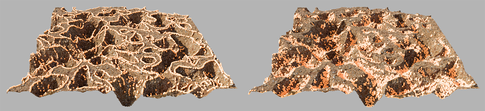
This filter category allows you to specifically display instances only on outwardly curved, Convex areas or on inwardly curved, Concave areas. The Concave filter can then be used, for example, to place loose rocks only in the valleys and dips of a terrain, regardless of their elevation within the landscape.
Here, you can choose whether the object should react to filter settings at all, and whether these are determined by the Scatter object or by the Scatter tag:
-
Off: Neither the filters configured by the Scatter object nor those configured by the Scatter tag are applied.
-
Inherit: This is the default setting, which causes the tag-carrying object to receive only the filters from the Scatter object.
-
Override: Enable this mode to apply the filter settings set in the tag to the object, thereby overriding the Scatter object's filter settings.
Depending on the selected Mode, you can define a minimum and a maximum angular deviation—based on the maximum outward (Convex) or inward (Concave) curvature—for which instances should remain visible.
This allows you to reverse the visibility of the instances filtered out by Curvature filtering.
This allows you to create a transition between the unoccupied areas and the areas covered by instances. At high values, the result is the same as if Curvature filtering were turned off.
Here, you can choose whether the instances should remain visible only on the outwardly curved (Convex) areas, the inwardly curved (Concave) areas, or on all curved areas (Both).